Tocht Stappen Le Thillot - Le Thillot (Haut-du-Them - Château-Lambert) 18 600m +762m - Photo

Le Thillot (Haut-du-Them - Château-Lambert) 18 600m +762m

 DanielROLLET
DanielROLLET

Gebruiker

© OpenStreetMap contributors
Lengte
Lengte
18,6 km
Max. hoogte
Max. hoogte
791 m
Positief hoogteverschil
762 m
Km-Effort
Km-Effort  
29 km
Min. hoogte
Min. hoogte
470 m
Negatief hoogteverschil
758 m
Boucle
Boucle
Ja
Datum van aanmaak :
2022-04-05 07:59:59.992
Laatste wijziging :
2022-04-06 07:10:09.848

(0 Bericht)

Stappen
Stappen
7h00
Moeilijkheid : Medium

Scan deze QR-code om de tocht te openen in de SityTrail-applicatie

Gratisgps-wandelapplicatie

Logo SityTrail SityTrail

IGN / Geografische instituten

SityTrail uit de App Store downloaden SityTrail uit Google Play downloaden

Logo SityTrail SityTrail World

De wereld gaat voor u open

SityTrail uit de App Store downloaden SityTrail uit Google Play downloaden SityTrail op Huawei AppGallery downloaden

Over ons

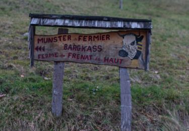
Tocht Stappen van 18,6 km beschikbaar op Grand Est, Vogezen, Le Thillot. Deze tocht wordt voorgesteld door DanielROLLET.

Beschrijving

2022 04 05 avec Marie - 10h00 à 17h00
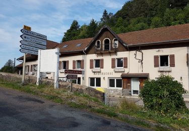
13h15 à 14h30 repas à l'Auberge de la Source.
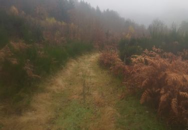
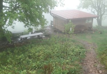
Temps frais et humide

Hoogteprofiel

Plaatsbepaling

Land:
France
Regio :
Grand Est
Departement/Provincie :
Vogezen
Gemeente :
Le Thillot
Locatie:
Unknown
Vertrek:(UTM)
332242 ; 5305081 (32T) N.

Wandeltochten in de omgeving

Tocht Stappen Le Ménil - Boucle au départ des chalets de la
Stappen
dboon

Stappen

Gemakkelijk
(3)
Le Ménil, Grand Est, Vogezen, France
10 km | 14,1 km-effort
3h 0min
Ja
Tocht Mountainbike Saint-Maurice-sur-Moselle - SityTrail - 3248441 - documentxix745004916x3256137 - Photo
Mountainbike
GUIDE
pascalou73

Mountainbike

Medium
Saint-Maurice-sur-Moselle, Grand Est, Vogezen, France
21 km | 30 km-effort
2h 3min
Ja
Tocht Te voet Fresse-sur-Moselle - Les ballons à l’horizon - Photo
Te voet
PRO

Te voet

Gemakkelijk
Fresse-sur-Moselle, Grand Est, Vogezen, France
7,7 km | 12,6 km-effort
2h 51min
Ja
Tocht Stappen Haut-du-Them-Château-Lambert - Chateau-Lambert mines de cuivre et source de l'Oignon - Photo
Stappen
ballet

Stappen

Gemakkelijk
(1)
Haut-du-Them-Château-Lambert, Bourgondië-Franche-Comté, Haute-Saône, France
9,6 km | 14,6 km-effort
2h 30min
Ja
Tocht Stappen Fresse-sur-Moselle - Croix de Fresse - Vosges - France - Photo
Stappen
boulou300

Stappen

Medium
(1)
Fresse-sur-Moselle, Grand Est, Vogezen, France
13,4 km | 19,6 km-effort
3h 10min
Ja
Tocht Stappen Le Thillot - Col des Croix - Vierge des Neiges - Hautes Mines - Tête des Noirs Étangs - Château Lambert - Photo
Stappen
Bart2015

Stappen

Gemakkelijk
Le Thillot, Grand Est, Vogezen, France
10,5 km | 16 km-effort
2h 23min
Ja
Tocht Stappen Saint-Maurice-sur-Moselle - Le Ballon de servance - Photo
Stappen
margotte

Stappen

Medium
Saint-Maurice-sur-Moselle, Grand Est, Vogezen, France
14,1 km | 22 km-effort
3h 40min
Ja
Tocht Stappen Le Ménil - Grande boucle au départ des chalets de la Feigne sur de l'Eau - Photo
Stappen
dboon

Stappen

Moeilijk
Le Ménil, Grand Est, Vogezen, France
21 km | 31 km-effort
5h 31min
Ja
Tocht Stappen Le Ménil - Le Ménil - Balade des deux chapelles - Photo
Stappen
dboon

Stappen

Moeilijk
Le Ménil, Grand Est, Vogezen, France
13,8 km | 21 km-effort
3h 23min
Ja


Sluiten
Mijn abonnementen